


Geodetske škole imaju ključnu ulogu u pružanju učenicima potrebnog znanja i vještina u području geodezije.Integracija najnovijih
geodetskih instrumenata u takve obrazovne ustanové može značajno poboljšati iskustvo učenika i bolje ih pripremiti za primjenu u
stvarnom svijetu.Najnoviji geodetski instrumenti nude napredne značajke i mogućnosti koje mogu pružiti studentima intenzivnije
iskustvo učenja.Korištenjem ovih instrumenata, studenti mogu steći praktično iskustvo u prikupljanju podataka, analizi itumačenju, što su ključne vještine u području geodezije.
U suradnji sa STONEX S.r.l. Italija, geodetskoj školi u Splitu isporučili smo najnovije totalne stanice, teodolite i GNSS prijemnike.
CHCNAV GIS Data Collector Ultra Rugged Android RTK Controller HCE600
|
Detailed Product Description
|
CHCNAV Ultra-Rugged Android Controller HCE600 With 5.5 Inches HD Display
Product Description HCE 600 exceeds all the requirements for your field surveying applications
Shanghai, China - November 19, 2021 - CHC Navigation (CHCNAV) announced the HCE600, a professional, lightweight, and compact field data collector with an alphanumeric keypad specifically designed for field surveying and mapping operations. With connectivity modules including Bluetooth 5.0, dual-band 2.4G and 5G Wi-Fi, and 4G modem, the HCE600 connects seamlessly and reliably to GNSS receivers and RTK network correction sources.
To withstand harsh surveying and weather environments, the HCE600 is designed to survive shock, dust, and water. Its 5.5-inch Asahi DragonTrail™ HD+ display is ultra-rugged and scratch-resistant, providing long-term performance and great protection against everyday wear and tear or accidental drops from up to 1.5 meters. The HCE600 also comes with a 90-day trial version of the LandStar Surveying and Mapping App, which integrates cloud services to easily share data and enable one-click remote support from anywhere.
Integrating the powerful 8-core Helio MTK 6762 processor, the HCE600 delivers the best performance, runs 50% faster, and consumes 25% less power than its predecessors. The Android 10 operating system enables smooth CAD drawing management and base map display without delay, resulting in increased productivity. High-performance LPDDR4 memory transfers data faster, allowing for instant uploads of large project files.
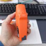
Figure 1. Front and Back sides of HCE600 data controller
The high-resolution screen displays complex surveys, DXF base maps, and data tables in incredible detail, enhancing the user's viewing experience. With up to 500 nits brightness, data is easy to read in all weather conditions, whether in direct sunlight or in the rain.
Figure 2. HCE600 data controller is installed on i73 GNSS receiver for a survey
Specification Why Choose Us GEODETSKOJ ŠKOLI SPLIT isporučujemo STONEX totalne stanice, teodolite i GNSS prijemnike |
| Product Tags: CHCNAV GIS Data Collector HCE600 GIS Data Collector Rugged Android rtk controller |
Related Products

|
KOLIDA H10 GNSS Controller South GPS Rtk Gnss Data Collector Device |
|
CORS GIS Data Collector SunNav M10 GNSS GPS Base Rover Station RTK Receiver |

|
GNSS RTK Measuring GPS GIS Collectors CHCNAV Controller P9V For FOIF Stonex |

|
HCE700 Android Data Collector Device Controller CHCNAV For X16 Pro GNSS RTK |
|
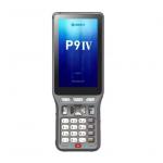
Handheld GPS GIS Data Collector Controller CHCNAV P9IV For FOIF Stonex |
|
Kolida Survstar C10 Handheld GIS Data Collector Sanding GNSS RTK Egstar Software 7500mAh |
Email to this supplier